

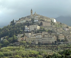
This walk begins at the bus stop in Piazza Garibaldi, which is just outside the outer circuit of walls (1264). The piazza was originally called Piazza del Lago because it was used to store water running off the mountain. The lake augmented the town's physical defences by protecting this most vulnerable part of the walls. This section of the walls was demolished in 1910, along with the Porta del Lago, which was at the entrance to Via Roma (on your right if Bar Chalet, the most obvious point of reference in the piazza, is behind you).
Piazza Garibaldi is not particularly attractive, unless it happens to be market day. Proceeding anti-clockwise:
-
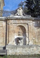
✴Fontana dei Cavalli (1579), which is now set into the wall to the right of Banco Populare, was originally in Piazza del Comune (now Piazza Mazzini - see below). The column of the fountain, which was reused from an earlier structure, has four lions' heads and the arms of the Church, the Commune, [and three noble families: the Varano of Camerino; the Monaldeschi of Orvieto; and the Trinci of Foligno].
-
✴The Civic Hospital beyond stands on the site of the ex-church and convent of San Domenico, [which stood on the site of a small hill that was used for public executions.]
-
✴The war memorial is on the left of the hospital.
-
✴A short detour along Via delle Fonti takes you to Villa Fabri (1603), which was acquired by the Commune in 2000 and opened to the public in 2008.
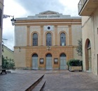
Return to via Roma, and the church of San Giovanni Decollato on the left. Detour a short way along its right side to see the buildings that housed the adjacent hospice.

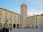
Leave Piazza Mazzini by Via Beato Placido Riccardi, opposite Palazzo del Comune.
There must have been a gate in the inner circuit of walls at the junction with Via San Filippo (the second turning on the right). This is the circuit that was built after the sack of 1214, probably on Roman foundations.
Turn right here, following the line of the inner walls, past Palazzo Approvati on the right. The street leads into Piazza della Rocca, which must have been the site of the Rocca di Trevi. The ex-church of San Filippo Neri on the left probably stands on the site of the fortress, and Palazzo Valenti della Prepositura is on the right.
Cross the piazza diagonally to the left. The closed side entrance of Sant’ Emiliano is in front of you. Turn left here, past the apse and apsidal chapels of the earlier church and turn right to reach the entrance. This is the highest point in the city and was originally the centre of what was probably a walled acropolis.
Palazzo Lucarini is opposite the entrance to Sant’ Emiliano.
[There is an interesting house (15th century) at 21 Via Beato Placido Riccardi].

The huge Palazzo Petroni follows on the right:
-
✴Walk along its left side and look to the right when you reach the junction with Vicolo del Sette to see a second façade.
-
✴Turn left along Vicolo del Sette into Piazza Mazzini and then turn right and immediately right again to leave the piazza along Via Dogali. Turn right at the T-junction along what is still Via Dogali to see the third and finest of the palace’s three facades.
Portico del Mostaccio ahead, which was another gate in the inner walls, has been incorporated into Palazzo Petroni Bartolini. Walk up the steps on the right to see the view from the bifore window above it. The ex-church of San Pio V (also incorporated into Palazzo Petroni Bartolini) is the next building on the right.
Turn left along Via Cavour, passing the ex-church and nunnery of San Bartolomeo on the left. Turn right at the end along Via del Fiscale, which is named for Benedetto Valenti, who was papal treasurer to Pope Clement VII and Pope Paul III. The two circuits of walls coincide from the point, and there are fine views from the terrace to the left.
[What seem to be Roman foundations and a pedestrian gate are visible somewhere near this point.] The aedicule on the left is all that remains of the ex-church of Santa Reparata.
The inner walls swung away from the terrace just before this point, and you are now entering the part of the city that was developed between 1214 and 1264. The terrace continues along the line of the outer walls, with fine views of San Martino (see below) ahead and below.
Continue into Largo Don Bosco and the entrance to the museum complex of Trevi, which is housed in a wing of the ex-convent of San Francesco that was built in front of the façade of the church in the 19th century. Make a clockwise circuit of the church to see its apse and then the fine portal in its right side. Alessandro Valenti paid for the paving of Piazza San Francesco (in front of the portal) in 1560. If you stand with the portal behind you, Palazzo dei Valenti di Riosecco is on the left, at the junction with Via San Francesco.
Walk along Via dell' Ospizio, which is parallel and to the left of Via San Francesco. This street is named for the Chiesa dell' Ospizio and the adjacent hospice, which stood on the left, near the junction with Piazza Mazzini.
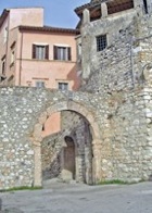
The church of San Constanzo (12th century), which stood outside this gate on the site of the martyrdom of St Constantius, was demolished in 1890. The author Virginia Ryan, who lived in Trevi, writes about her discovery of what seem to be the remains of this church in her garden in her book , "Where the Cypress Rises".
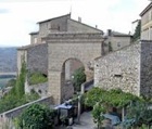
Take the right fork here along Via della Piaggia. The word "piaggia" means "slope", and it refers here to the suburb that developed on the hillside outside the walls in the early 13th century. It was enclosed in the outer walls in 1264. The ex-church and hospice of Santo Stefano are on the left, just before another street merges from the left.
Continue down past the pink façade of Palazzo Petrelli on the right into Piazza della Piaggia, the site of the ex-church of Santa Maria in Sion.
-
✴Palazzo Valenti, il Collegetto is on the left; and
-
✴Palazzo Valenti is in front of you.
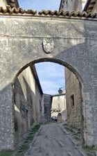
In the 16th century, Benedetto Valenti decorated this arch with Roman sculptures from his celebrated collection, two of which are now in the Museo della Città e del Territorio.
Return to Piazza della Piaggia and take a short detour along the lower road on the left (Via del Crocifisso, which is signed to Santa Lucia), to the Chiesa del Crocifisso on the right. The demolished church of Santa Maria della Piaggia was probably between the Chiesa del Crocifisso and the church and nunnery of Santa Lucia, which is at the end of this street.
Return to Piazza della Piaggia and continue down along Via del Priorato, which meanders down to Santa Croce. (You can see the façade of the church from the start of the street, but it takes a few twists and turns to reach it.)
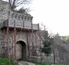
Detour A (below) to the Madonna delle Lacrime starts here and ends at Piazza Garibaldi.
This is an alternative to the shorter walk to Piazza Garibaldi below.
If you decide to leave the detour for later, return to Piazza della Piaggia and Piazza della Torre. The steps to the right of Palazzo Valenti take you back to Via Fiscale. Follow the street along the terrace through Largo Don Bosco and continue into Piazza Garibaldi, where the main walk ends.
Detour B (below), which takes you to a number of interesting churches on the outskirts of Trevi, starts and ends here.
Detour A: Madonna delle Lacrime
This detour of about 2 km begins at Santa Chiara.
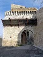
Retrace your steps and walk through the Porta San Fabiano, past the Chiesetta di Sant' Antonio da Padova on the right.
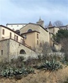
You will soon see the imposing façade of the Madonna delle Lacrime below. A path to the right cuts across the last sharp bend in the road and takes you directly to the church.
When you leave the church, walk up towards the city, pass the road to the left signed to Santa Lucia and take the next left. This winds steeply up to to Porta della Strada Nuova (signed to Hotel Trevi). Take the fork to the right, just before this gate, which leads to Porta del Cieco. Turn right just before the gate and follow the walls back to Piazza Garibaldi, where the detour ends.
Detour B: Other Outlying Churches
You can walk to two interesting churches from Piazza Garibaldi:
-
✴Viale Ciuffelli, the leafy road between the hospital and Bar Chalet, leads to San Martino (about 1 km).
-
✴Via Coste San Paolo and Via Orto degli Spiriti lead to the cemetery (signed to the left) and the church of Sant' Antonio Abate (about 1 km). The church is closed and abandoned but this is a nice walk with fine views of Trevi.
You will probably want to take a taxi to see the other important churches outside Trevi:
-
✴Santa Maria di Pietrarossa, although it is a pleasant walk of some 3 km along country lanes (put ‘Via Pietrarossa, 11’ into Googlemaps);
-
✴San Tommaso, although, if you are walking to Santa Maria di Pietrarossa, this complex (now a private home) is at end of Via del Giardini, slightly to the left, as you cross the main road to continue along Via Pierarossa; and
Return to the home page on Trevi.

