
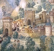
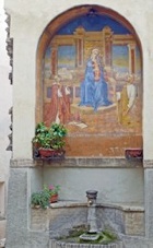
Detail from the Annunciation (1500) by Pinturicchio
Cappella Bella, Santa Maria Maggiore
A large necropolis, which was discovered in 1977, extended south from Portonaccio (i.e. behind you) towards the railway station. Although many of the tombs had been disturbed, two remained largely in tact and the grave goods that they contained could be dated to ca. 200BC. A fibula (7th century BC) was also discovered here. A third tomb, which was discovered in 1979 in Via Baldini (across Via Centrale Umbra and parallel to it), contained grave goods that were about 100 years older. Some of these finds are now exhibited in Palazzo Bianconi.

Take a short detour by along Via Sant’ Anna to the church of Sant’ Anna. (It is only open for services).
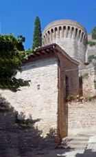
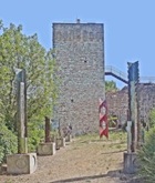
Return to the first circular tower and follow the path to the right of it, which runs along the walls. Continue to a second circular tower next to Porta Chiusa, so-called because it was blocked up for a considerable period. Walk through the gate and up the steps and turn right along Via Sambucaro. This ends after the ruins of a large square tower in the walls. Continue into the car park and left along the main road below to Porta Prato.
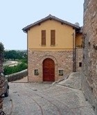
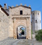
Turn right here (along what is still Via Madonna della Rosina) and right at the end along Via del Fonte del Mastro. The facade of Santa Maria del Prato is on the right. The Spello Card allows access to this church, which now contains a museum of musical instruments.
Turn right along Via Giulia, past
-
✴Teatro Subasio at number 28-32 on the right;
-
✴an interesting house (14th century) at number 93 on the left; and
-
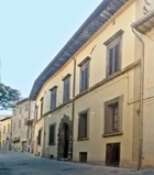
✴Palazzo Benedetti Cianetti (17th century), at number 34 on the right.
Turn right again and the left to continue along Via Giulia.
-
✴The ex-nunnery of Santa Chiara is at number 107-13 on the left.
-
✴The (usually closed) Oratorio di San Biagio is at number 94 on the right.
This space opens into Piazza Vallegloria, which is dominated by Santa Maria di Vallegloria. Unfortunately, this important church is usually closed.
The long detour below starts from here, as do the following two short detours:
-
✴Turn right outside Porta Montanara along the main road and then fork left along Via San Girolamo to San Girolamo and the cemetery.
-
-
-
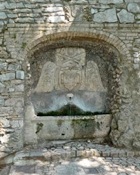
✴With Porta Montanara behind you, turn left along Via Poeta, past a fountain (16th century), which incorporates the arms of Pope Paul III and of two cardinals, above a medieval sarcophagus. It was moved here from a site near San Claudio (visited in Walk III).
-
-
-
-
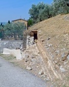
Retrace your steps and take the next turning on the left (signed to Collepino). Fork left by the sign that marks the end of Spello to see the remains of the Roman aqueduct.
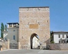
Return to Porta Montanara and then to Piazza Vallegloria. Turn left in front of the church and then right along Via Fontevecchia, which runs along the side of the nunnery. This leads to Porta Fontevecchia:
-
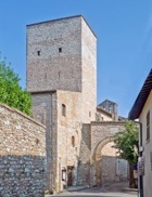
✴the vestiges of the medieval walls to the left of it originally continued to Torre Santa Margherita (see below); and
-
✴the medieval walls to the right enclosed the nunnery.
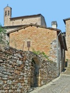
Continue along Via Torre di Properzio: he house at number 37 on the left (now Ristorante Porta Venere) is the reputed birthplace of the Blessed Andrew Caccioli. Continue into Piazza Matteotti, where the walk ends.
Detour
This detour from Porta Montanara, which takes in:
-
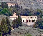
✴two abandoned nunneries in the hills outside Spello;
-
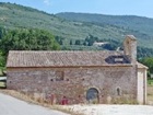
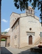
✴the church of the important abbey of San Silvestro; and
-
✴the Roman aqueduct.
It is probably best done in part by taxi. Get the driver to take you to the first three of these monuments and then to drop you outside Collepino, at the start of the aqueduct. The easy and interesting walk along the aqueduct to Porta Montanara takes about an hour.