
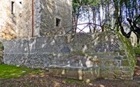
Pliny the Elder recorded that, like Arretium (Arezzo), Mevania (Bevagna) had walls built of unbaked clay. This suggests that the settlement was walled early in the 3rd century BC. In fact, by the time that Pliny writing (i.e. in the 1st century AD), Bevagna had walls made from stone, but he could have been relying on information about an earlier circuit that no longer survives.
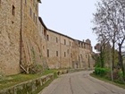
The stone walls (1st century AD) provided the foundations for much of the later circuit of walls. However, the Roman municipium probably extended further to the north and not so far to the south as the present settlement, as described below. Its walls were rebuilt after soldiers of the Emperor Frederick II destroyed Bevagna in 1249. They were badly damaged when Bevagna joined the Ghibelline uprising against the Trinci in 1377, and Corrado II Trinci subsequently restored and reinforced them.
Itinerary
Piazza Filippo Silvestri to Porta Foligno
The walk begins in Piazza Filippo Silvestri, which has been the main square of Bevagna since the Middle Ages. Leave the piazza along Corso Giacomo Matteotti, which follows the line of the Roman Via Flaminia, the cardo maximus of the Roman municipium. Continue to the junction of with Via Gabriele Crescimbeni (to the left) and Via Santa Margherita. These two streets probably formed the decumanus maximus, and the junction was probably the site of the Roman forum:
-
✴Via Gabriele Crescimbeni runs to Porta Cannara in the medieval walls; no trace survives of its Roman predecessor, which must have been a little way beyond it; and
-
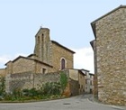
✴Via Santa Margherita runs to the church of Santa Margherita, which stands on what must have been the site of another Roman gate.
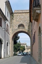
You will pass both of these later in the walk. Continue along Corso Giacomo Matteotti to Porta Foligno, the point at which Via Flaminia left the city.
Porta Foligno to Porta Cannara
Detour A (see below), to the church of the Madonna della Rosa and the site of the
Roman amphitheatre begins and ends outside Porta Foligno.
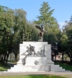
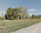
Walk into Parco Silvestri and continue through it, to follow the medieval walls in an anti-clockwise direction.
-
✴Excavations [when?] near the wall, just beyond the war memorial, unearthed the remains of a Roman structure.
-
✴Excavations in 1884 of a temple nearby is documented, but no visible trace of the temple itself survives.
-
•A polychromed terracotta antefix (4th century BC) that was found here in the 1990s, which presumably came from this temple, is now in the Museo Archeologico, Perugia.
-
•Fragments of an arm and a leg from a colossal statue (now in the Museo Archeologico, Bevagna, probably of a seated male divinity, had been found here two year earlier.
-
✴The finds at the lowest level come from what seems to have been an archaic settlement ( 7th century BC). They include:
-
•the remains of dry stone walls that belonged to the oldest stone buildings that have been found in Umbria;
-
•the remains of a furnace, which suggests that rich clay deposits in the area supplied a local ceramic industry from a very early date; and
-
•three ditch tombs used by this community.
-
Other finds from these excavations (now in the Museo Archeologico, Perugia) include:
-
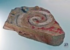
•an architectural decoration in the form of a gargoyle with the shape of a cat’s head;
-
•a number of impasto and bucchero pottery fragments; and
-
•a loom weight.
-
✴Those from the upper levels come from what seems to have been a cult site, which was first monumentalised in the 3rd century BC and which was extended and restored at the time of the Emperor Hadrian (117-38 AD).
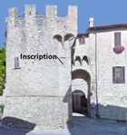
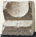
According to Simone Sisani (referenced below, at pp. 417-8) Via I Maggio probably follows the line of the ‘via triumphalis’ (triumphal way), which is known from an inscription (CIL XI 5041) that was discovered in 1589 under the street (now stepped) from Piazza Garibaldi to San Francesco (directly behind you - see also Walk I). The inscription, which is now in the Museo Archeologico, records the names of a group of freedmen who had financed its paving with “lapide hispellate” (stone from Spello). It seems likely that the original inscription named nine men and identified them as the members of the novemviri Valetudinis. This road might have connected the sanctuary here to the sanctuary at the Laghetto dell’ Aisillo (see Detour B below), and then continued Hispellum (Spello), the site of the important Roman sanctuary at what is now Villa Fidelia.
Continue across park to the exit and turn left to Porta Cannara.
Detour B (see below) to the Chiesa dell’ Annunziata and Lake Aiso
begins and ends outside Porta Cannara.
Porta Cannara to Porta Sant’ Agostino
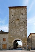
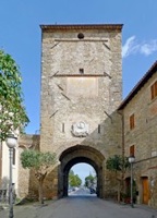
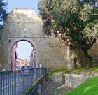
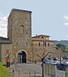
Porta Cannara (13th century), which is also known as Porta San Giovanni or Porta Perugia, is the best preserved of the medieval city gates. As noted above, it straddles what was the decumanus maximus of the Roman municipium: the corresponding Roman gate must have been a little way further from the town centre.
Continue to Porta Sant’ Agostino: as mentioned above, the city walls and the point at which Via Flaminia entered the city from the south seem to have been slightly further north along Corso Giovanni Amendola.
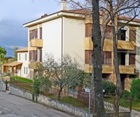
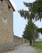
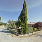
Take a short detour by continuing ahead across the canal and the river. Cross Via Timia ans continue ahead along Via Sant’ Antonio (ahead) leads to the villa Le Contessine. The cypress trees draw attention to it. Two interesting Roman inscriptions survive in the garden (although I could not see them from the road):
-
✴A funerary inscription (CIL XI 5044, 1st century AD) commemorates Statilia Nebris, the wife of the freedman Caius Arruntius Hermes, novemvir Valetudinis and sevir sacris faciundis.
-
✴A second funerary inscription (CIL XI 5047, 2nd century AD)commemorates the freedman C(aius) Attius Ianuarius, who was also a novemvir Valetudinis and sevir sacris faciundis: he had left a considerable sum to his guild, the collegio dei centonarii (the guild of manufacturers of patchwork covers known as centones, who financed the ercetion of the cippus) to finance an annual banquet in his memory for at least 12 men on the festival of the Parentalia.
Return to Porta Sant’ Agostino, where this short detour ends.
Porta Sant’ Agostino to Porta Foligno
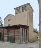
First turn right, towards the river. The portico ahead was built here in 1924, over the old washhouse in which the women of Bevagna used to do their laundry. From here. you can see the mill pond mentioned above, but you will get a different perspective of it during the next detour.
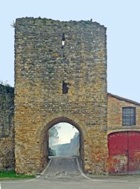
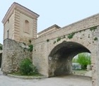
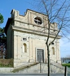
For this second detour, retrace your steps to the start of the cycle path and continue ahead. The sustaining wall of the pensile Largo Antonio Gramsci is in front pf you. Walk along the left side and of it (along Via Porta Molini) and up the steps into the piazza (with the lovely apse of San Silvestro ahead). Make a U-turn to your right here see the square towers that flank Porta Todi (which were once used for customs purposes), and continue across the bridge: like Largo Antonio Gramsci, the gate towers and the bridge were built in 1881-96. Having crossed the river, turn around to see:
-
✴the mill pond (which you saw from a different perspective a moment ago), below on the left; and
-
✴the cycle path along which you will soon be walking, below on the right.
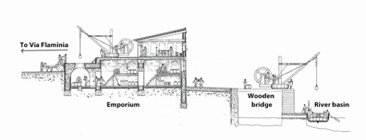
Emporium and river port, from Camerieri and Manconi (referenced below, Figure 7)
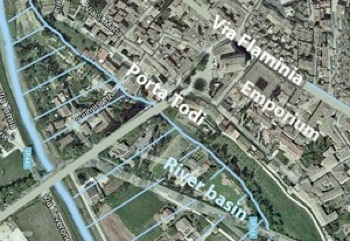
The land between the city walls and what is now Via Teverone was part of a riverine basin that served as a port bringing goods to Mevania in Roman times. A wooden bridge here allowed merchandise to be hauled across the city wall and into the Roman warehouse under San Domenico (marked “Emporium in the reconstruction above - see Walk I) for onward transport on Via Flaminia (and vice versa).
Detour C (see below) to Santa Maria delle Grazie begins and ends at Porta Todi.

Continue to Porta Foligno and retrace your steps along Corso Giacomo Matteotti to Piazza Filippo Silvestri, where the walk ends.
Detour A
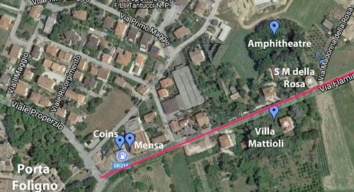
This short detour to the church of the Madonna della Rosa and the site of the Roman amphitheatre begins and ends outside Porta Foligno. The aerial view of the route illustrated above was constructed using this brilliant page from the website of Archeo Bevagna.
Cross Viale Properzio and continue along the SS 316 (which probably follows the line of the Roman Via Flaminia). Two important archaeological discoveries were made on the site of the first petrol station on the left:
-
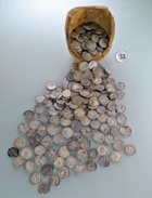
✴A hoard of 911 coins, which included dateable coins from the period 211-115 BC, was found here in 1929. Part of this hoard is displayed [in Perugia - check]: unfortunately, the other part, which was originally exhibited locally, was later stolen.
-
✴An altar top known as the mensa dei magistri Valetudinis with a Latin inscription (CIL XI 7926, first half of the 2nd century AD) that associates it with this magistracy was found here [when ?]. The altar top is now in the Museo Archeologico.
A Roman mosaic was discovered in the grounds of the now-derelict villa Mattoli, opposite the church., which suggests the presence here of a villa.
There is no point in walking further along Via Flaminia, but it is interesting to note that there were two necropolises further along it on the left:
-
✴an Iron Age necropolis (7th - 6th century BC) was discovered in the Vigna Boccolini in the early 20th century , but the grave goods have been dispersed; and
-
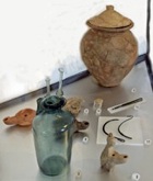
✴seven funerary urns from the Republican period were discovered in the late 19th century at Fabbrica, just beyond it, on land belonging to the Serafini family. The cover of an urn (ca. 100 BC) that contains an Umbrian inscription (see also the page on Umbrian Inscriptions after 295BC) that was found here is now in the Museo Archeologico.
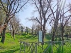
Retrace your steps towards Porta Foligno. It is possible to get a better view of the site of the amphitheatre by taking a short detour on the way back (although, it truth, the site was more overgrown in 2017 that it was in 2010, when I took the photograph above, and there was not much to see): turn right along Via XXV Aprile and right again along Via Sant’ Anna. Pass the Centro di Salute (Health Centre) and turn right along its wire fence (before Via Imbersato), across a field and down to the fence around the site.
Continue to Porta Foligno, where the detour ends.
Detour B
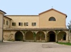
This detour to the Chiesa dell’ Annunziata and Lake Aiso, which begins and ends at Porta Cannara, takes about 1 hour (ca. 5 km) return.
You will pass Via Colle Poppo on the right, at the boundary between Bevagna and the village of Capro. Remains that suggest the presence of a Roman necropolis (known as the necropoli di of Colle Poppo) that was in use in the Republican period have been found here.
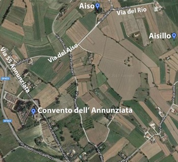
Turn left on leaving the convent along another branch of Via del Convento to rejoin Via SS Annunziata.
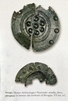
-
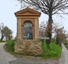
✴This small all, deep freshwater lake surrounded by trees is on the left. Bronze votive offerings (6th - 5th century BC) that were found here in the 18th century suggest that this was an ancient cult site that was probably devoted to a river god.
-
✴The second site, the Laghetto dell’ Aisillo, is on private land. To reach it, turn right, just beyond Lago dell’ Aiso, along Via del Rio: the excavations of the cult site here that were carried out in 2004-5 took place in the field to your right.
Return to Porta Cannara, where the detour ends.
Detour C
This detour to Santa Maria delle Grazie, which begins and ends at Porta Todi, takes about an hour return and involves a steep climb.
Leave Bevagna through Porta Todi, and cross the bridges over both branches of the river.
Fork right along Via Madonna delle Grazie.
Return to Porta Todi, where the detour ends.
Read more:
S. Sisani, “I Rapporti tra Mevania e Hispellum nel Quadro del Paesaggio Sacro della Valle Umbra”,, in
G. Della Fina (Ed.), “Il Fanum Voltumnae e i Santuari Comunitari dell’ Italia Antica”, (2012) Orvieto (pp. 409-64)
P. Camerieri and D. Manconi, “Le Centuriazioni della Valle Umbra da Spoleto a Perugia”, Bollettino di Archeolgic Online, (2010) 15-39
Return to Walks in Bevagna.