
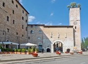
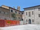
The walk begins Piazza Kennedy, outside the Roman Porta Consolare.

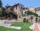
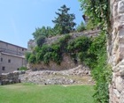
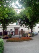
Turn left along Via Torre di Belvedere, which ends at a viewing platform that offers a magnificent view of San Claudio, the remains of the Roman amphitheatre and Villa Fidelia (all visited in Walk II), and of the countryside beyond. This is the highest part of the town, and was probably the site of the arx (citadel) of the Roman colony. A fine stretch of the Roman walls support the viewing platform and the Roman Porta dell’ Arce to the right was probably named for the arx.
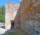
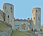
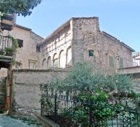
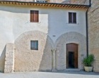
The site was later used for a succession of fortresses. Only a single tower of the last of these, Rocca dell’ Albornoz survives, beside the ancient church of San Severino. This walls of the garden of the convent here stand on the foundations of the Roman walls. Retrace your steps to San Martino and turn left along Via Arco di Augusto, which runs along its right wall. This leads to the vestiges of Arco di Augusto.
Turn right along Via Giulia, which was named in honour of the visit of Pope Julius II to Spello in 1507:
-
✴The Oratorio di Sant Antonio is at number 8 on the left.
-
✴The Oratorio della Morte and the adjacent San Gregorio Magno are just beyond on the left.
-
✴Sant’ Ercolano is also on the left, on the junction with Via Sant’ Ercolano.
The north end of Largo Mazzini (opposite and to the right as you leave San Lorenzo) was the site of the oratory and hospice of San Giacomo. This complex housed the ex-Collegio Vitale Rosi from 1832, and was later adapted as a school. Part of it passed into private ownership in 1990 and now houses:
-
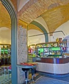
✴Bar Tullia (6 Largo Mazzini);
-
✴the Residence San Jacopo (holiday apartments in 1 Via Borgo di Via Giulia).
The Biblioteca Comunale Giacomo Prampolini (entered through the atrium of the school)has occupied part of the complex, including the ex-oratory, since 2007.
The buildings to the south of Largo Mazzini belonged to the Monastero di San Giovanni Battista until 1816. The Oratorio di San Giovanni Battista (in the centre of the photograph to the right), which was the nuns’ chapel , is still used for services (in substitution for San Lorenzo, above).
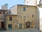
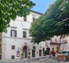
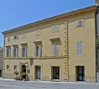
Continue along Via Garibaldi to Palazzo Urbani at number 19 on the right. This street then runs along the side of Palazzo Comunale Vecchio:
-
✴Turn into the entrance on the left at number 6 Via Garibaldi and along the passage that houses the Lapidarium.
-
✴The steps to the left lead up to the rooms on the first floor of the palace that are open to the public.
-
✴The visit also includes the Emilio Grecco Collection on the second floor.
-
✴Return to the ground floor and continue through the Lapidarium into Piazza della Repubblica.
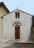
Continue along Via Ospedale, which swings to the left on the far side of the piazza. The ex- Oratorio di Santa Maria della Misericordia is on the right, opposite the junction with Via della Misericordia.
Continue under the arch into Via Cavour. Take a detour by turn right along Via Cavour and left under the arch to the left of Sant’ Andrea (see below). The office of Pro Loco Spello is on the left, just after the arch. [Remains of the Roman aqueduct under glass in the floor of the office.]

North side of Piazza della Repubblica East side of Piazza della Repubblica
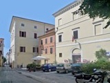
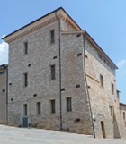
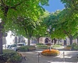
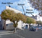
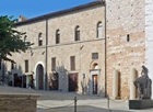
Walk along the east side of Piazza della Repubblica, past the front of Rocca Baglioni, the Scuola Media “Galileo Ferraris” and the Post Office. The history of the development of the east side of the piazza is complex:
-
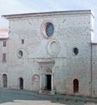
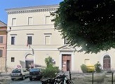
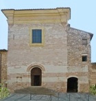
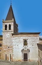
✴When Palazzo Comunale Vecchia, on the north side of the piazza, was extended to the east in 1567-75, the piazza itself was also extended: such was the slope here that the new street level was above the old ground floor rooms of the buildings to the east. Thus, for example, the old church of San Rufino at the north east corner was interred, and the church of San Filippo was built above it.
-
✴The piazza took on its present appearance in 1960, when San Filippo was adapted to house the Post Office, and the Scuola Media “Galileo Ferraris” was built to the right (using part of the fabric of Rocca Baglioni).
The trees that now make it such a lovely shady place were planted at the time of the 1960 development.
Walk across the facade of Palazzo Comunale Vecchia and turn left along Via Cavour, which runs along the west side of Piazza della Repubblica. This takes you past the following palaces on the right:
-
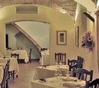
✴Palazzo Urbani di Piazza (17th century ?), which now houses Caffé Cavour;
-
✴Casa Bianchi (1502), which now houses the Osteria de Dada. The inscription over the portal, above the arms of the Bianchi family, reads “SCIENTIA INFLAT KARITAS AEDIFICAT MDII”
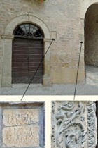
Walk through the arch of Palazzo Priorale into the inner courtyard:
-
✴there are two Roman travertine capitals (1st century AD) to the sides of the steps leading to the entrance to the palace; and
-
✴the remains of a loggia (1510) can be seen in the right wall of Santa Maria Maggiore: as described in the page on the church, the arches of this loggia were later closed to form the present atrium.
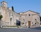
Return to Via Cavour. The church and nunnery of Santa Maria Maddalena are opposite Santa Maria Maggiore.
Continue to the junction with three streets: Via Porta Chiusa; Porta Consolare; and Via Sant’ Angelo. The last of these is named for the ex-church of San Michele Arcangelo, which is on the right, at number 16c. Cappella Tega is opposite.
Continue along Via Consolare:
-
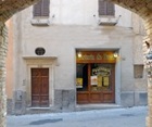
✴The first shop on the left (at 78-84 Via Consolare) belongs to the important artist, Elvio Marchionni.
-
✴Casa Bovi (17th century), at number 41 on the right, has a tiny inner courtyard. There is a Roman bust (1st century AD) embedded in the above a pilaster in the wall opposite the entrance to it.
-
✴The ex-Oratorio di San Bernardino is at number 60 on the left, as the street swings to the right.
-
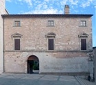
✴The huge ex-Palazzo Venanzi (15th century), at number 25-7 on the right, has two portals that bear the Venanzi arms. The palace passed to the Confraternita del SS Sacramento di Santa Maria Maggiore, possibly in 1602, when the family built what is now Palazzo Venanzi Preziosi in Via Torre Belvedere.
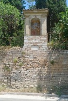
Take a short detour along Via Borgo San Sisto 1 on the left to see remains of the facade of the church of San Sisto (next to number 10). Return to Via Consolare continue to Porta Consolare, where the walk ends.