

-
✴Finds made at the lower levels included:
-
•the remains of many rooms from a building that probably formed part of the Roman baths (1st century BC); and
-
•a broadly contemporary domus.
-
These marked the first stages of the expansion of the city into the plain to the south in the 2nd century BC, as the Romans began the construction of the city of Iguvium. Some ceramics found here are exhibited in the Antiquarium.
-
✴The remains in the layer above included those of a Christian basilica and cemetery that apparently date to the brief period of the Lombard occupation of Gubbio in the 8th century. The remains of seven sarcophagi were found in the cemetery, one of which is now in the Museo Civico.
Continue to Porta degli Ortacci, at the southern perimeter of the medieval city, and turn right along Viale del Teatro Romano (with the city walls on your right). Walk under the walls and through the car park to see material uncovered during the excavations mentioned above:
-
✴a Roman structure, behind railings on the left, which was probably a cistern associated with the thermal complex described above; and
-
✴a number of ancient stones laid out in an ellipse in the space beyond it. [More on what these are]
Cross Viale del Teatro Romano to begin the so-called Percorso Archeologico.
Percorso Archeologico
This walk around Roman Iguvium (illustrated above) takes in an area on the left side of Viale del Teatro Romano that is also bounded, Viale Parruccini, Via Ubaldi, Via Perugina and Via Matteotti and bisected by Via Bruno Bozzi. All of the Roman structures mentioned are described in more detail in the page "percorso archeologico".
Your first stop is the Antiquarium in the car park. It is housed in a building above the remains of a Roman domus, the mosaic floor of which can be seen. It also contains an interesting archeological collection, much of which relates to the immediate area.
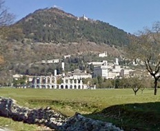
The ticket for the Antiquarium also includes access to the Roman theatre (although you can walk around the field in which it stands and see it from the outside for free).
Having seen the theatre, walk to the far right hand corner of the field (to the corner of Viale Parruccini and Via Ubaldi) to see a stretch of Roman wall. This wall seems to have had no defensive function: it probably simply supported the terrace on which Iguvium was built.
Walk back to the theatre and then turn right: if the gate at the edge of the field is open, you can walk along the path here to the rest of the excavated area, across Via Bruno Bozzi. At the time of my visit in April 2014 the gate was locked, and the itinerary below is written on that basis.
Return to and turn right along Viale del Teatro Romano to the junction with Via Bruno Bozzi. Take a short detour by crossing the latter, and walk to the terrace behind the buildings immediately on the left (which include Caffé Europa). You can see some of the excavated remains tin what is now a car park. The terrace looks down on the field in which the rest of the excavations took place in the area known as Guastuglia.
Return to the junction with Via Bruno Bozzi and turn left along it. You will see the path from the Roman theatre on your right. It continues on the other side of the road, and this is the entrance for tours of the Guastuglia site that are possible in the summer months. (I have yet to do this tour).
Continue along Via Bruno Bozzi to the junction with Via Salvador Allende. The field on the left on the far side of the junction contains:
-
✴a Roman mausoleum (the so-called mausoleum of Lucius Pomponius Grecinus); and
-
✴the so-called scarico di San Biagio, a huge deposit of ceramics dated from the 4th to the late 2nd century BC.
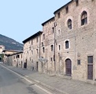
Return along Via Bruno Bozzi and turn right slong Via Matteotti to Largo di Porta Marmorea. This space (an adjunct to Piazza 40 Martiri) is named for Porta Marmorea: this city gate that was demolished in 1863, together with a long stretch of walls to the sides of it, to make way for junction of the roads to Ancona and Perugia (Via Matteotti and Via Perugina).
Return to and continue along Via Perugina.. There were two nunneries along this stretch of road in the 13th century that later moved to Santo Spirito (visited in Walk I):
-
✴Santa Maria del Paradiso, which stood near the present site of Santa Maria del Prato; and
-
✴San Sperandio, further along on the left.
Cross Via Perugina, turn right, and walk behind the first block of buildings to see the confluence of the Camignano and Cavarello torrents below. This vicinity, which probably had religious significance for the ancient inhabitants of the city. A small necropolis of about 10 graves was recently discovered here. Grave goods (1st century AD) from one of these tombs (Tomb 6) are exhibited in the Museo Archeologico, Perugia:
-
✴a glass funerary urn; and
-
✴an ink pot made up of a glass inner part and a gilded silver outer cover.
Turn left on leaving Santa Maria della Piaggiola, along Via della Piaggiola, and turn left into Via Frate Lupo. Excavations in 1989 at the southern end of Via Gandhi, the first turning on the right, uncovered ten inhumation graves dating to the 5th century BC:
-
✴four attic vases (5th century BC) from these tombs are exhibited in the Antiquarium; and
-
✴a column krater (425-400 BC) from Tomb 1 is exhibited in the Sala dei Bronzi of the Museo Archeologico, Perugia.
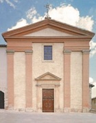
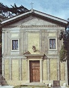
Continue along Via Frate Lupo, past the modern building on the left (60 Vale Vittorina) that houses the headquarters of a cement company, Collacem Spa. The main part of the Vittorina necropolis was found here during construction of this building in 1980. Excavations here in 1980-2 uncovered some 237 tombs, mostly from the period 1st century BC - 2nd century AD, which were spread out across an area that extended across Via Frate Lupo into the park in front of the church of Santa Maria della Vittoria (below):
-
✴Some finds from this part of the necropolis are exhibited in the Antiquarium.
-
✴Others (from Tomb 221) are exhibited of the room in the Museo Archeologico, Perugia that I have labelled Roman Umbria I.
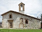
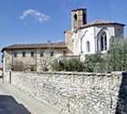
Having seen the church, cross Via Frate Lupo, and continue along Viale Vittorina. Take the second turning on the left (Via Giosue Carducci). This road curves past the apse of Santa Maria della Piaggiola (above) and the ditch of the Cavarello on your left. Turn left along Via Ugo Foscolo and left at the end along Viale Rimembranze. This road was dedicated in 1924 to the 403 men of Gubbio who had died in the First World War, and 403 holm oaks were planted along it in memory of them.
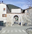
Detour to the churches of San Felicissimo (15 minutes one way) and
Santa Maria del Suffragio di San F (a further 15 minutes one way).
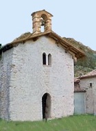
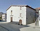
Walk back along Via di Porta Romana to Porta Romana itself, where the detour ends.

Leave Sant’Ubaldo by the side door in the cloister, cross the road and climb the step scree path ahead. It passes under a screen of scaffolding and then divides into two narrower paths. The path straight ahead leads to the subsidiary fortifications, while that to the left leads to the main part of Rocca Posteriore.
Walk down Monte Ingino.
You can, of course, take the cable car back to Porta Romana.
Alternatively, this walk of some 2 km along the Corso dei Ceri , which takes you to
Porta Sant’ Ubaldo.
However, if you also want to walk to San Girolamo (below), you will then need to walk
back along Via Appenino, towards Porta Romana.
The winding path down the mountain was laid out in 1604 and forms part of the route for the annual Corsa dei Ceri, passing three small chapels, each standing on a hairpin bend:
-
✴San Michele Arcangelo (the Terza Cappelluccia), which stands on the site of a chapel that was built in 1154 to celebrate Gubbio’s famous victory agains eleven surrounding cities
-
✴the Chiesa della Beata Vergine delle Grazie (the Seconda Cappelluccia), which was built in 1657 and which is also known as San Giorgio
-
✴the Cappellina dell’ Annunzione (the Prima Cappelluccia), which was built by Bishop Alessandro Sperelli in the 17th century.
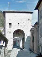
Follow the path down to Porta Sant’ Ubaldo (below), where the detour ends.
This itinerary assumes that you have returned from Sant’ Ubaldo on the cable car. A bridge in the car park at the cable car station takes you inside the city walls. Turn right, through Arco San Marziale and walk to the right of the church of San Marziale, along Via Appenino. (Both the arch and the church are visited in Walk I).
The Stradone San Girolamo on the right is signed to San Girolamo.
This lovely walk up the quiet asphalt road takes about 45 minutes one way.
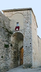
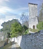
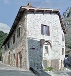
A detour of about 1 km along the main road runs along the gorge of the Camignano
to the Gola del Bottaccione (see also the excursion towards the Eremo di Fonte Avellana).
Take the path along the right side of Santa Croce and then continue along the footpath beside the road. The reservoir that channels water into the aqueduct is just after the Osteria del Bottaccione.
The alternative path from Porta Sant’ Ubaldo was closed at the time of my visit in April 2014.
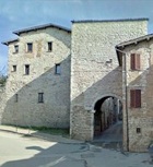
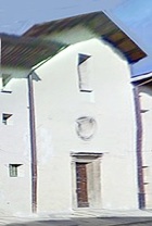
Continue to the arch across the road: there is a Marian oratory under it ,on the righthand side of the road.
Return to the double ramp and turn left up the first one (which involves turning through almost 180°). The section of cyclopean walls ahead on the left may have protected the Augural Way of the Umbrian city of Ikuvina. In 1920, the archaeologist Vittorio Pagliari (1846-1923) found the remains of a Paleolithic settlement nearby.
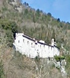
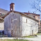
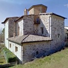
The Park Hotel ai Cappuccini on the left occupies the ex-Convento di San Nicolò dei Cappuccini.
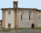
You rejoin the city walls here as they curve around the impressive apse of San Domenico (visited in Walk I). Follow them to the right as far as the next roundabout and then walk into the car park behind San Domenico. Bear right to the part of the ex-convent to the right of the apse and take the pedestrian walkway near the steps.
Turn right along Via Cavour, passing:
-
✴Palazzo Pamphili on the right (whose interesting courtyard opens onto Piazza Bosone ahead); and
-
✴Palazzo Toschi Mosca on the left, which now houses the Casa di Riposo Mosca.
Cross Piazza Bosone and continue along Via Cavour into Piazza 40 Martiri, where the walk ends.
Return to the Walks and Excursions in/from Gubbio.
