
-
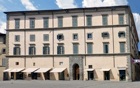
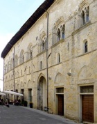
✴the back of the main wing of the palace (which you saw from the front in Piazza Mateottoi) is on your right; and
-
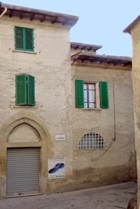
✴the older wing, which is known as Palazzo Vitelli all'Abbondanza, is on on your left.

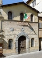
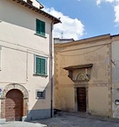
SS Apollinare e Lucia San Sebastiano Chiesa di Buon Consiglio
Continue to the junction with Via del Popolo:
-
✴the ex-church of SS Apollinare e Lucia is on the right;
-
✴the ex-church of San Sebastiano is on the left, at number 7; and
-
✴the Chiesa di Buon Consiglio is just beyond it, at number 9.
-
✴the first portal belonged to the church of Santa Luciola, the headquarters of the Università dei Fabbri (blacksmiths’ guild); and
-
✴the unit at number 14 housed a workshop belonging to the Ubaldini della Carda family.
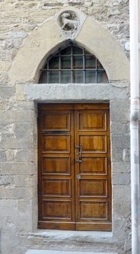
The imposing portal of this part of the palace is at the junction with Via Cerboni.
Turn right at the end of Via del Popolo, along Via Angeloni: the Supermercato all’ Abbondanza at this junction is named for the palace. Turn right again to return to Piazza Matteotti, where this detour ends.
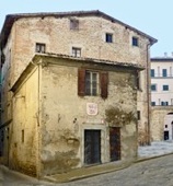
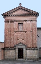
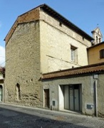
There are two interesting buildings on the opposite side of the street:
-
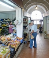
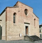
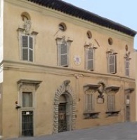
✴The ex-church of San Paolo al Macello (at number 6, illustrated above) was suppressed in 1807.
-
•Its ground floor housed the fish market from 1862 and was adapted to house a more general market in 1958.
-
•The Tipografia Grifani Donati in its upper part can be visited.
-
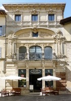
✴The ornate facade (1908) of the palace next door (at number 4) was commissioned by the Ricci-Valenti family from Vincenzo Rossignoli. It now houses the excellent Caffé Cavour.
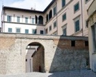
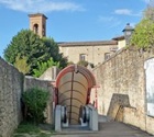
Walk through barrel vault under Palazzo del Podestà on the left: the entrance to the palace is on your right as you walk through it. Continue to the open portico (17th century) against its rear facade, in Piazza Fanti.
Rione San Florido (del Prato)
Turn right and walk diagonally across Piazza Fanti and then continue along Via del Rialto.
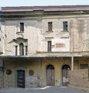
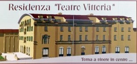
This street passes Piazza dell’ Incontro on the left. A local tradition has this (somewhat improbably) as the site of a meeting between SS Francis and Dominic in 1217. The Monastero di Santa Margherita operated here in the period 1574-1773. The site then housed the Teatro Bonazzi, which was renamed in 1918 as ex-Teatro Vittoria after the “victory” of the First World War. It became a cinema after the Second World War and is now (2013) being adapted as apartments.
Continue along Via delle Legne (past Caffé Academia). You can detour here, by turning left to see the magnificent circular campanile of the Duomo, although you can also reach it from a door inside the church (below).
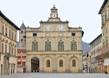
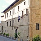
Palazzo Vescovile Palazzo dei Priori and Duomo
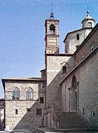
The piazza is named for Venanzio Gabriotti, a military hero and prominent anti-Fascist from Città di Castello who was executed by the German SS in 1944. It was possibly the site of the Roman forum and became the civic and ecclesiastical centre of the medieval city. Turn left to cross the piazza and look back (perhaps from the terrace of Caffè Magi) to get the best view of :
-
✴Palazzo Vescovile on the left, with the Torre Civica beyond it; and
-
✴Palazzo dei Priori on the right, just beyond the left wall of the Duomo (below).
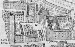
Detail from the plan (ca. 1675) of Città di Castello
by Filippo Titi (Biblioteca Comunale “Giosue Carducci”)

Continue along Via Cacciatori del Tevere as it swings to the right. It runs along what was the left wall of the original church of Sant‘ Agostino [11]. Turn left into Via Borgo Inferiore: the facade of the original church of Sant’ Agostino was at this junction.
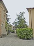
Via della Scatorbia Via Antimo Marchesani, with
Pomerio Sant’ Agostino to the right
Retrace your steps and continue along Via Antimo Marchesani to the city wall, passing two interesting streets on the right:
-
✴Via della Scatorbia follows the line of the ancient torrent of that name.
-
✴Pomerio Sant’ Agostino, which runs inside the city walls, probably continued to the left, behind the Convento di Sant’ Agostino, until the earthquake of 1789.
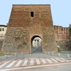
Walk through the gap in the wall ahead, which was opened in 1944 to allow people to find safety during the bombardment of the Second World War.
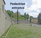
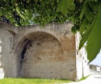
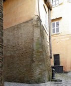
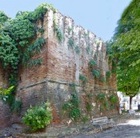
However, first take a short detour by continuing around the outside of the walls to see the remains of the Cassero (1375), which now support the Giardini del Cassero (below).
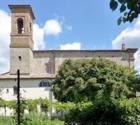
As you leave the garden, you have a fine view of the facade of the Duomo. The ex- Canonica to the right of it (in Via della Pendinella) houses the Museo del Duomo.
Turn left on leaving the Museo del Duomo. Palazzo della Porta closes the piazza ahead.
Continue to the junction with Via Pomerio San Florido: the Porta San Florido originally stood just beyond it.
Take a short detour by continuing ahead and across the roundabout to the bridge over the Tiber. Excavations in 1910 of a site between the city wall and the river uncovered a large public building with at least four rooms paved in black and white mosaics (now lost). An inscription (1st century AD) in Palazzo Comunale, which was probably also found here, records a temple dedicated to Venus Victrix (Venus the Conqueror) that was built by Lucius Arronius Amandus, a sextum vir augustalis (one of the six priests of the city who presided over the cult of the Emperor Augustus). Cristina Migliorati (referenced in the page on Roman Città di Castello) has suggested that this building and the temple were associated with a river port analogous to that at Pagliano, near Orvieto.
Retrace your steps to the junction with Via Pomerio San Florido and turn right along it.
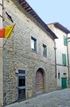
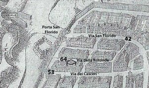
Take a short detour along Via della Rotonda on the left to the building at number 12. The remains of the circular building known as la Rotonda were found here in 1988 (although its existence was already known from the city plan (ca. 1675) by Filippo Titi illustrated above, where the structure is labelled 64). The original purpose of this building is unknown, but it apparently dates to the late 12th century.
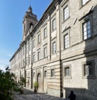
Return to Via Pomerio San Florida and turn left along it to Palazzo Vitelli alla Cannoniera, which houses the Pinacoteca Comunale.
Rione Santa Maria (della Mattonata)
Via Pomerio San Florida continues as Via Borgo Farinario. Continue to the junction with Via Guglielmo Oberdan and turn left along it.
-
✴Gaius Palius, son of Gaius, a member of the equestrian order to whom the urban plebs dedicated honours, probably after his death; and
-
✴Gaius Tussidius Marcianus, an aedile (magistrate).
These men presumably contributed to the cost of building the amphitheatre or to that associated with the spectacles that were held here.
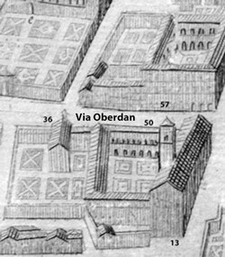
Detail from the plan (ca. 1675) of Città di Castello
by Filippo Titi (Biblioteca Comunale “Giosue Carducci”)
Turn left along Via Guglielmo Oberdan. The Oratorio di Santa Caterina [36], which stood in the orchard of the convent of San Domenico (below), was demolished 1942 to make way for an extension to the tobacco factory. An area of black and white mosaic (2nd century AD) that was discovered nearby in the 1950s was apparently recomposed in a nearby house.
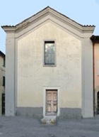
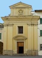
Santa Croce: Facade in Piazza del Garigliano Campanile seen from Via Signorelli
Turn right on leaving the church, and walk to the junction with Via Luca Signorelli (which runs along its left wall). Take a short detour by turning left here. The campanile visible behind number 13a on the right (on the extreme right of the picture above on the left) belongs to the ex-church of Santa Croce. Take the next turn on the right and turn right again into Piazza del Garigliano to see its facade.
Turn right at the far end of Piazza San Giovanni in Campo into Via del Borghesi and continue to the junction with Via dei Gauri, on the right. The mosaics (1st century BC) that have been found at number 4 Via del Borghesi (just beyond this junction) are the oldest Roman objects surviving in the city.
Return to Via Luca Signorelli, and turn left and left again along Via del Gemignano, which runs behind the apse of San Domenico. Fragments of Roman mosaics (2nd century AD) have been found in private house at number 2, on the left.
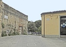
Turn right along Via delle Santucce, which swings to the left. This street is named for the now-demolished Monstero delle Santucce, which was built outside Porta Santa Maria (below) in ca. 1271.
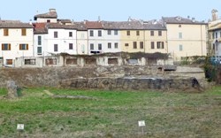
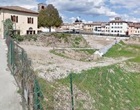
As noted above, Via delle Santucce along the north side of the excavated area of the site of the now-demolished Fattoria Autonoma Tabacchi:
-
✴fragments of Roman mosaics (2nd century AD) have been found in private house at number 26; and
-
✴the remains of what seem to have been the public baths have been unearthed at the south west corner of the excavated site (illustrated above), at the junction with Via Borgo Farinaria.
Detour to Convento di San Giovanni Battista (Zoccolanti) - about 40 minutes return
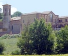
Retrace your steps to Porta Santa Maria Maggiore, where the detour ends
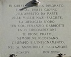
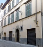
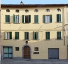
Turn right to continue along Corso Vittorio Emanuele and take another short detour along Via Guglielmo Marconi, to the left to see the Palazzo del Monte di Pietà (16th - 18th centuries) at number 4a. The inscription records the foundation of the Società di Mutua Cristiana Beneficenza in 1846 and names its founder, Giovanni Battista Rigucci and other contributors. Traces of frescoes are visible around this inscription.
Return to Corso Vittorio Emanuele and continue into Piazza Matteotti, where the walk ends.